Category:Bucknell, Shropshire
Jump to navigation
Jump to search
village and civil parish in Shropshire, UK  | |||||
| Upload media | |||||
| Instance of | |||||
|---|---|---|---|---|---|
| Location | Shropshire, West Midlands, England | ||||
| official website | |||||
 | |||||
Subcategories
This category has the following 2 subcategories, out of 2 total.
B
- Bucknell railway station (28 F)
M
Media in category "Bucknell, Shropshire"
The following 200 files are in this category, out of 234 total.
(previous page) (next page)-
 "Adams" chair Bucknell (1294419).jpg 1,000 × 713; 125 KB
-
 "The Cottage" Bucknell (1293886).jpg 1,000 × 710; 102 KB
-
 'Bucknell' from the Knowle (1294640).jpg 1,000 × 707; 99 KB
-
 'In the fields' 'evening' (near Bucknell) (1294730).jpg 1,000 × 711; 76 KB
-
 'Lingen bridge' Bucknell (1294864).jpg 1,000 × 714; 130 KB
-
 'On the river' 'Bucknell' (1294206).jpg 1,000 × 1,376; 209 KB
-
 'Park View' (1293924).jpg 1,000 × 716; 89 KB
-
 'River scene' Bucknell (1295042).jpg 1,000 × 718; 110 KB
-
 'The weir' Bucknell (1294000).jpg 1,000 × 717; 140 KB
-
 A Backlit Yew - geograph.org.uk - 4644406.jpg 905 × 1,356; 933 KB
-
 Alright, we'll take your word for it. - geograph.org.uk - 2415012.jpg 640 × 480; 173 KB
-
 B & J Davies (Bucknell) Ltd - geograph.org.uk - 3821687.jpg 2,945 × 1,912; 1.07 MB
-
 B & J Davies - geograph.org.uk - 3151301.jpg 640 × 360; 221 KB
-

-

-
 B4367 south of Bucknell - geograph.org.uk - 2379881.jpg 640 × 430; 58 KB
-
 B4367 to Lingen Bridge - geograph.org.uk - 2379879.jpg 640 × 430; 43 KB
-
 B4367, Bucknell - geograph.org.uk - 2389860.jpg 640 × 430; 40 KB
-
 Baron of Beef, Bucknell - geograph.org.uk - 591382.jpg 640 × 426; 111 KB
-
 Bridge over the Redlake - geograph.org.uk - 4159815.jpg 800 × 600; 484 KB
-
 Bridge over the River Redlake - geograph.org.uk - 2554195.jpg 1,024 × 768; 180 KB
-
 Bridge over the River Redlake, Bucknell - geograph.org.uk - 1526841.jpg 640 × 480; 105 KB
-
 Bridgend Lane, Bucknell - geograph.org.uk - 1526961.jpg 480 × 640; 150 KB
-
 Bucknell (1294831).jpg 1,000 × 701; 129 KB
-
 Bucknell 01.JPG 2,848 × 2,136; 2.98 MB
-
 Bucknell 02.JPG 2,848 × 2,136; 3 MB
-
 Bucknell bridge (1293724).jpg 1,000 × 710; 107 KB
-
 Bucknell buildings (10) (geograph 6925127).jpg 4,312 × 3,234; 3.67 MB
-
 Bucknell buildings (6) (geograph 6923917).jpg 4,320 × 3,240; 3.67 MB
-
 Bucknell buildings (8) (geograph 6925059).jpg 4,223 × 3,167; 2.63 MB
-
 Bucknell buildings (9) (geograph 6925084).jpg 4,222 × 2,375; 1.9 MB
-
 Bucknell Ford - geograph.org.uk - 4294486.jpg 3,872 × 2,592; 4.83 MB
-
 Bucknell from Lampitts (1293379).jpg 1,000 × 703; 66 KB
-
 Bucknell from the Knoll (1294523).jpg 1,000 × 704; 75 KB
-
 Bucknell Hill - geograph.org.uk - 3929808.jpg 640 × 480; 283 KB
-
 Bucknell Hill - geograph.org.uk - 655048.jpg 640 × 480; 93 KB
-
 Bucknell House and orchard (1294480).jpg 1,000 × 714; 109 KB
-
 Bucknell houses (1) (geograph 6923906).jpg 4,236 × 3,176; 3.6 MB
-
 Bucknell houses (10) (geograph 6925069).jpg 4,320 × 3,240; 4.71 MB
-
 Bucknell houses (11) (geograph 6925072).jpg 4,320 × 3,240; 3.4 MB
-
 Bucknell houses (12) (geograph 6925075).jpg 4,320 × 2,430; 2.34 MB
-
 Bucknell houses (13) (geograph 6925115).jpg 4,320 × 3,240; 2.91 MB
-
 Bucknell houses (14) (geograph 6925120).jpg 4,320 × 3,240; 3.77 MB
-
 Bucknell houses (15) (geograph 6925124).jpg 4,320 × 3,240; 4.03 MB
-
 Bucknell houses (3) (geograph 6923934).jpg 4,135 × 3,101; 3.66 MB
-
 Bucknell houses (4) (geograph 6923937).jpg 4,320 × 3,240; 3.39 MB
-
 Bucknell houses (5) (geograph 6925040).jpg 4,272 × 2,403; 2.47 MB
-
 Bucknell houses (7) (geograph 6925057).jpg 4,135 × 3,101; 2.94 MB
-
 Bucknell houses (8) (geograph 6925063).jpg 4,223 × 3,167; 2.19 MB
-
 Bucknell houses (9) (geograph 6925066).jpg 4,320 × 3,240; 3.52 MB
-
 Bucknell Pop 29006 image001.png 902 × 528; 12 KB
-
 Bucknell post office (1294371).jpg 1,000 × 712; 115 KB
-
 Bucknell post office (1294739).jpg 1,000 × 704; 111 KB
-
 Bucknell Post Office - geograph.org.uk - 704206.jpg 640 × 435; 69 KB
-
 Bucknell Primary School - geograph.org.uk - 2389841.jpg 640 × 430; 38 KB
-
 Bucknell railway yard - geograph.org.uk - 3939529.jpg 4,042 × 2,029; 2.6 MB
-
 Bucknell school (1293428).jpg 1,000 × 716; 102 KB
-
 Bucknell School - geograph.org.uk - 704116.jpg 600 × 601; 187 KB
-
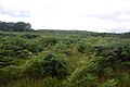
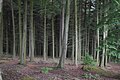
 Bucknell Wood - geograph.org.uk - 5495076.jpg 1,024 × 683; 554 KB
-
 Bucknell Wood - geograph.org.uk - 5495085.jpg 427 × 640; 82 KB
-
 Bucknell Wood - geograph.org.uk - 655088.jpg 640 × 480; 99 KB
-
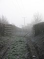
 Byway to Lower Lye - geograph.org.uk - 5483280.jpg 640 × 480; 97 KB
-
 Car Park - geograph.org.uk - 3821671.jpg 3,023 × 1,629; 952 KB
-
 Chapel Lawn Road, Bucknell - geograph.org.uk - 5494514.jpg 1,024 × 576; 297 KB
-
 Chapel Lawn Road, Bucknell - geograph.org.uk - 5494522.jpg 1,024 × 576; 301 KB
-
 Church Rd. Bucknell (1293717).jpg 1,000 × 705; 115 KB
-
 Clearing, Bucknell Wood - geograph.org.uk - 5494569.jpg 1,024 × 683; 318 KB
-
 Conifer block, Bucknell Wood - geograph.org.uk - 5494557.jpg 1,024 × 683; 423 KB
-

-
 Coxall Baptist Church - geograph.org.uk - 3821578.jpg 3,264 × 2,448; 4.65 MB
-
 Coxall Baptist Church - geograph.org.uk - 3821617.jpg 3,264 × 2,448; 3.98 MB
-
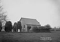 Coxall chapel Bucknell (1293883).jpg 1,000 × 712; 81 KB
-
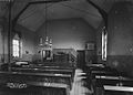 Coxall chapel Bucknell (1294109).jpg 1,000 × 716; 78 KB
-
 Coxall Knoll - geograph.org.uk - 3304013.jpg 1,600 × 1,200; 1.91 MB
-
 Crane, B&J Davies - geograph.org.uk - 2381664.jpg 640 × 430; 51 KB
-
 Crush and pens - geograph.org.uk - 640224.jpg 480 × 640; 62 KB
-
 Cwm Cottage - geograph.org.uk - 3544329.jpg 1,600 × 1,200; 750 KB
-
-
 Darky Dale Lane near Ferny Dingle - geograph.org.uk - 655136.jpg 640 × 472; 38 KB
-
 Distant view of Caer Caradoc - geograph.org.uk - 159267.jpg 640 × 480; 142 KB
-
 Drive over Child(ren) - geograph.org.uk - 3821636.jpg 3,264 × 2,448; 3.56 MB
-
 Entering Bucknell - geograph.org.uk - 655098.jpg 640 × 465; 47 KB
-
 Entering Bucknell, B4367 - geograph.org.uk - 2381655.jpg 640 × 430; 78 KB
-
 Entering Shropshire - geograph.org.uk - 2378092.jpg 640 × 430; 82 KB
-
 Evening sun in Bucknell - geograph.org.uk - 1526807.jpg 640 × 480; 116 KB
-
 Farmland in the Teme valley (geograph 7125664).jpg 1,600 × 1,069; 609 KB
-
 Farmland south of Bucknell - geograph.org.uk - 2379884.jpg 640 × 430; 54 KB
-
 Field by the lane to Bucknell - geograph.org.uk - 2378097.jpg 640 × 430; 65 KB
-
 Field, Mynd - geograph.org.uk - 3151283.jpg 640 × 360; 203 KB
-
 Field, Mynde - geograph.org.uk - 3151265.jpg 640 × 360; 218 KB
-
 Footbridge, River Redlake, Bucknell - geograph.org.uk - 1526914.jpg 640 × 480; 156 KB
-
-
 Footpath in Bucknell - geograph.org.uk - 1526821.jpg 640 × 480; 82 KB
-
 Footpath sign, Bucknell - geograph.org.uk - 3151272.jpg 640 × 360; 250 KB
-
 Ford and footbridge over the Redlake in Bucknell - geograph.org.uk - 3939524.jpg 4,048 × 1,857; 3.46 MB
-
 Ford on the River Redlake - geograph.org.uk - 2822452.jpg 1,600 × 1,270; 784 KB
-
 Ford, River Redlake, Bucknell - geograph.org.uk - 1526877.jpg 640 × 480; 186 KB
-
 Ford, River Redlake, Bucknell - geograph.org.uk - 1526899.jpg 640 × 480; 157 KB
-
 Ford, River Redlake, Bucknell - geograph.org.uk - 1526953.jpg 640 × 480; 190 KB
-
 Gate into Oakhill Wood - geograph.org.uk - 2379871.jpg 640 × 430; 88 KB
-
 Gated Field near Bucknell - geograph.org.uk - 4979199.jpg 3,576 × 1,907; 1.44 MB
-
 Grassy path, Bucknell Wood - geograph.org.uk - 5494567.jpg 1,024 × 683; 446 KB
-
 Green Farm - geograph.org.uk - 234303.jpg 640 × 480; 70 KB
-
 Hay bales near Lingen Bridge - geograph.org.uk - 2379876.jpg 640 × 430; 39 KB
-
 Horse Chestnut tree and telephone kiosk - geograph.org.uk - 2415027.jpg 640 × 480; 133 KB
-
 Horses and rainbow near Bryncalled - geograph.org.uk - 655011.jpg 640 × 480; 61 KB
-
 Horses near Bryncalled - geograph.org.uk - 655012.jpg 640 × 480; 93 KB
-

-
 House north of Lingen Bridge - geograph.org.uk - 2379877.jpg 640 × 430; 51 KB
-
 House on the edge of Bucknell - geograph.org.uk - 2389821.jpg 640 × 430; 47 KB
-
 K6 telephone kiosk in Bucknell, Shropshire.jpg 1,350 × 1,800; 448 KB
-
 Kissing gate at Hopton Wood - geograph.org.uk - 2415017.jpg 640 × 480; 172 KB
-
 Laid hedge near Oakhill Wood - geograph.org.uk - 2379864.jpg 640 × 430; 91 KB
-
 Laid hedge, the edge of Oakhill Wood - geograph.org.uk - 2378100.jpg 564 × 640; 118 KB
-
 Lane junction south of Bucknell - geograph.org.uk - 2379880.jpg 640 × 430; 66 KB
-
 Lane to Bucknell - geograph.org.uk - 2379874.jpg 640 × 430; 79 KB
-
 Lane to Bucknell - geograph.org.uk - 655099.jpg 640 × 480; 96 KB
-
 Lane up to and around Bucknell Hill - geograph.org.uk - 4256699.jpg 4,048 × 3,040; 4.77 MB
-
 Leaving Bucknell Wood - geograph.org.uk - 5495102.jpg 1,024 × 683; 401 KB
-
 Leaving the woods - geograph.org.uk - 2415004.jpg 640 × 480; 186 KB
-
 Llama grazing - geograph.org.uk - 3821604.jpg 2,537 × 2,103; 935 KB
-
 Lower Lye farmhouse - geograph.org.uk - 3859610.jpg 1,600 × 1,071; 381 KB
-
 Lower Lye Farmhouse 01.jpg 4,000 × 3,000; 4.54 MB
-
 Lower Lye Farmhouse 02.jpg 4,000 × 3,000; 5.01 MB
-
 Lower Lye Farmhouse 03.jpg 4,000 × 3,000; 4.92 MB
-
 Lower Lye Farmhouse 04.jpg 4,000 × 3,000; 2 MB
-
 Mature conifers, Bucknell Wood - geograph.org.uk - 5495078.jpg 1,024 × 683; 389 KB
-
 Mature trees on Bucknell Hill - geograph.org.uk - 1231155.jpg 481 × 640; 93 KB
-
 Memorial hall Bucknell (1294822).jpg 1,000 × 708; 74 KB
-
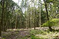 Mixed woodland, Bucknell - geograph.org.uk - 5494573.jpg 1,024 × 683; 541 KB
-
 Oaks, Bucknell Wood - geograph.org.uk - 5495054.jpg 1,024 × 683; 569 KB
-
 Old oaks, Bucknell Hill - geograph.org.uk - 3929812.jpg 640 × 480; 274 KB
-
 Old road over Stow Hill - geograph.org.uk - 5495048.jpg 1,024 × 683; 572 KB
-
 Old School House, Bucknell 01.jpg 3,070 × 4,052; 1.62 MB
-
 Old School House, Bucknell 02.jpg 4,000 × 3,000; 4.87 MB
-
 Old School House, Bucknell 03.jpg 4,000 × 3,000; 4.97 MB
-
 Ordnance Survey Cut Mark - geograph.org.uk - 4760085.jpg 480 × 640; 116 KB
-
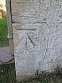 Ordnance Survey Cut Mark - geograph.org.uk - 4760088.jpg 480 × 640; 95 KB
-
 Ordnance Survey Cut Mark - geograph.org.uk - 4760090.jpg 480 × 640; 93 KB
-
 P.M. chapel Bucknell (1293513).jpg 1,000 × 711; 101 KB
-
 P.M. chapel Bucknell (3451537716).jpg 750 × 533; 139 KB
-
 Path in a gully, Bucknell - geograph.org.uk - 5494544.jpg 1,024 × 683; 455 KB
-
 Path in a gully, Bucknell - geograph.org.uk - 5494564.jpg 1,024 × 683; 576 KB
-
 Path junction, Bucknell Wood - geograph.org.uk - 5494551.jpg 1,024 × 683; 470 KB
-
 Pub sign, Baron of Beef - geograph.org.uk - 3929801.jpg 640 × 480; 324 KB
-
 R.G.E. Car Repairs, Bucknell - geograph.org.uk - 2381658.jpg 640 × 444; 42 KB
-
 Redlake valley road to Chapel Lawn - geograph.org.uk - 4256701.jpg 4,048 × 2,415; 3.83 MB
-
 Ribbon development, Bucknell - geograph.org.uk - 640221.jpg 640 × 480; 61 KB
-
 River Redlake (1) - geograph.org.uk - 2554205.jpg 1,024 × 768; 244 KB
-
 River Redlake (2) - geograph.org.uk - 2554211.jpg 1,024 × 768; 260 KB
-
 River Redlake - geograph.org.uk - 3929798.jpg 640 × 480; 371 KB
-
 River Redlake - geograph.org.uk - 3929803.jpg 640 × 480; 359 KB
-
 River Redlake - geograph.org.uk - 655094.jpg 640 × 480; 98 KB
-
 River scene Bucknell (1293444).jpg 1,000 × 701; 170 KB
-
 Road in Bucknell - geograph.org.uk - 1526838.jpg 640 × 480; 108 KB
-
 Road junction, Bucknell - geograph.org.uk - 1526845.jpg 640 × 480; 73 KB
-
 Road north of Bucknell Station - geograph.org.uk - 2389850.jpg 640 × 430; 42 KB
-
 Road over Stow Hill - geograph.org.uk - 5495080.jpg 1,024 × 683; 469 KB
-
 Road over Stow Hill - geograph.org.uk - 5495094.jpg 1,024 × 683; 457 KB
-
 Road signs in Bucknell - geograph.org.uk - 2381665.jpg 640 × 430; 67 KB
-
 Road signs in Bucknell - geograph.org.uk - 2387736.jpg 640 × 430; 67 KB
-
 Road to Bucknell - geograph.org.uk - 2554189.jpg 1,024 × 768; 121 KB
-
 Road, Bucknell Wood - geograph.org.uk - 5494528.jpg 1,024 × 576; 403 KB
-
 Road, Bucknell Wood - geograph.org.uk - 5494534.jpg 1,024 × 576; 438 KB
-
 Schoolyard Bucknell (1294288).jpg 1,000 × 1,397; 262 KB
-

-

-
 Small shed by the B4367, Bucknell - geograph.org.uk - 2381662.jpg 640 × 430; 45 KB
-
 Station Road Bucknell (1293808).jpg 1,000 × 717; 121 KB
-
 Summit track, Coxall Knoll - geograph.org.uk - 3156185.jpg 360 × 640; 272 KB
-
 Take the Rainbow Train to Shrewsbury - geograph.org.uk - 12067.jpg 640 × 480; 142 KB
-
 Thatch at Lower Lye - geograph.org.uk - 5483275.jpg 640 × 480; 75 KB
-
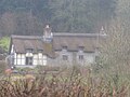
 Thatched cottage, Bucknell (1293395).jpg 1,000 × 1,430; 181 KB
-
 The "improved" causeway Bucknell (1293919).jpg 1,000 × 711; 100 KB
-
 The "Old Mill" Bucknell (1293805).jpg 1,000 × 718; 91 KB
-
 The "Old Mill" Bucknell (1295004).jpg 1,000 × 1,371; 139 KB
-
 The "scrubs" Bucknell (1294335).jpg 1,000 × 727; 68 KB
-
 The Baron of Beef pub - geograph.org.uk - 2821250.jpg 1,024 × 725; 231 KB
-
 The cottage Bucknell (1294932).jpg 1,000 × 716; 111 KB
-
 The lane from Bucknell to Chapel Lawn - geograph.org.uk - 298210.jpg 640 × 480; 87 KB
-
 The rear of the Baron of Beef pub - geograph.org.uk - 3544361.jpg 1,024 × 682; 176 KB
-
 The Redlake Valley - geograph.org.uk - 654980.jpg 640 × 481; 95 KB
-
 The road over Stow Hill - geograph.org.uk - 5494577.jpg 1,024 × 683; 529 KB
-
 The Sitwell Arms, Bucknell - geograph.org.uk - 3105124.jpg 640 × 480; 54 KB
-
 The square Bucknell (1294541).jpg 1,000 × 713; 110 KB
-
 The square Bucknell (1295069).jpg 1,000 × 716; 86 KB
-
 This way to Lower Lye Farm - geograph.org.uk - 2414989.jpg 640 × 480; 141 KB
-
 This way to Mynd Farm - geograph.org.uk - 2415034.jpg 640 × 480; 128 KB
-
 Track to Honeyhole - geograph.org.uk - 2554217.jpg 1,024 × 768; 147 KB
-
 Track to Woodside - geograph.org.uk - 2554226.jpg 1,024 × 768; 162 KB
-
 Tracks near Cwm Cottage Reserve - geograph.org.uk - 3543485.jpg 1,024 × 768; 432 KB
-
 Tree felling by the lane to Bucknell - geograph.org.uk - 2379866.jpg 640 × 430; 82 KB
-
 Trees by the River Teme - geograph.org.uk - 2378101.jpg 640 × 430; 96 KB
-
 Variety of hedges in Nettledale - geograph.org.uk - 450384.jpg 640 × 481; 96 KB
-
 Village Store - geograph.org.uk - 646138.jpg 640 × 430; 73 KB
-
 Weir cottage Bucknell (1294091).jpg 1,000 × 711; 117 KB
-
 Weir Cottage, Bucknell.jpg 1,800 × 1,350; 616 KB
-
 Weir house Bucknell (1295114).jpg 1,000 × 710; 109 KB
-
 Winter wheat south of Bucknell - geograph.org.uk - 2379885.jpg 640 × 430; 68 KB
-
 Yew Tree Cottage, Bucknell 01.jpg 4,000 × 3,000; 5 MB
.jpg)
.jpg)
.jpg)
_(1294730).jpg)
.jpg)
.jpg)
.jpg)
.jpg)
.jpg)


_Ltd_-_geograph.org.uk_-_3821687.jpg)


.jpg)


.jpg)
_(geograph_6925127).jpg)
_(geograph_6923917).jpg)
_(geograph_6925059).jpg)
_(geograph_6925084).jpg)

.jpg)
.jpg)


.jpg)
_(geograph_6923906).jpg)
_(geograph_6925069).jpg)
_(geograph_6925072).jpg)
_(geograph_6925075).jpg)
_(geograph_6925115).jpg)
_(geograph_6925120).jpg)
_(geograph_6925124).jpg)
_(geograph_6923934).jpg)
_(geograph_6923937).jpg)
_(geograph_6925040).jpg)
_(geograph_6925057).jpg)
_(geograph_6925063).jpg)
_(geograph_6925066).jpg)

.jpg)
.jpg)


.jpg)


.jpg)


.jpg)
.jpg)


_-_geograph.org.uk_-_3821636.jpg)


.jpg)


.jpg)


.jpg)
.jpg)


_-_geograph.org.uk_-_2554205.jpg)
_-_geograph.org.uk_-_2554211.jpg)


.jpg)


.jpg)


.jpg)


.jpg)
.jpg)
.jpg)
.jpg)
.jpg)

.jpg)


.jpg)
.jpg)


.jpg)

.jpg)

